Journeys
In late May-early June 2017, I traveled the more than 1,500-mile California Trail from Independence, Missouri to the Marshall Gold Discovery State Historic Park in Coloma, California (the location of Sutter’s Mill). I visited numerous landmarks along the way, and once in California, I took gold-panning lessons in the American River and hiked through the hills.
Below are my notes from that journey – some observation, some documentation, some rumination. All of it a map to the past.

Replica Prairie Schooner
Nebraska
Bunch of redwing blackbirds. Red ants. Platte is brown, serene, meandering. Bank drops off. Heavy vegetation on bank.
Sand Hill Ruts (Sutherland): Drive N on Pioneer Trace/Prairie Trace Rd. for 3.8 miles. Pullout on E side of road.
Ogallala: rolling hills, fewer trees.
From Ogallala to Lewellen: land much more dynamic, white sand, short grass, squatter trees. After Lewellen land gets flatter again. Still hilly to the west.
Ash Hollow: From junction of 207 and US 26, drive W 1.5 miles. Watch for entrance to Windlass Hill on W side of road.
Robidoux’s first trading post: S on 71 off 92. S of Gering turn W on Robidoux Road (watch for sign). 4 miles the road jogs N and then W. Continue another 4 miles. As road curves NW, watch for Robidoux Post Site on a low rise on the S side of the road (if you see sign for pioneer graves, 0.2 miles too far). Bluffs at back of Robidoux’s trading post. Birds tweeting, wind cutting across it. Air is cool.
Scotts Bluff National Monument: W on 92 from 71
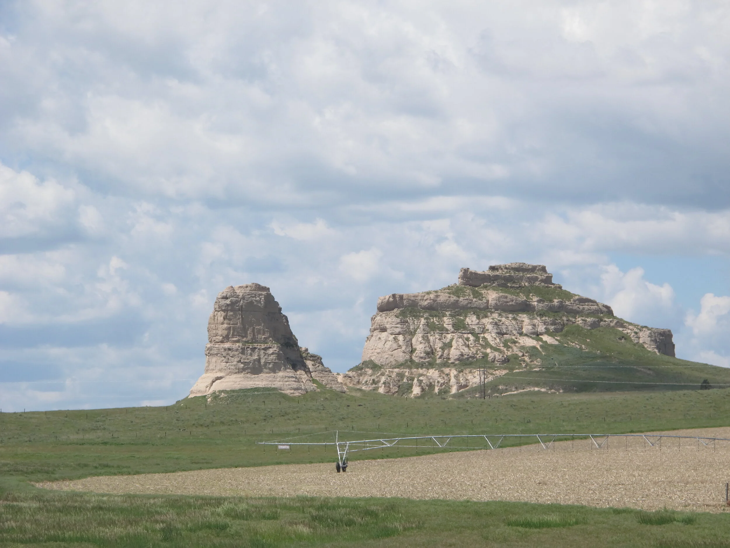
Courthouse Rock | Bridgeport, NE

Chimney Rock | Bayard, NE
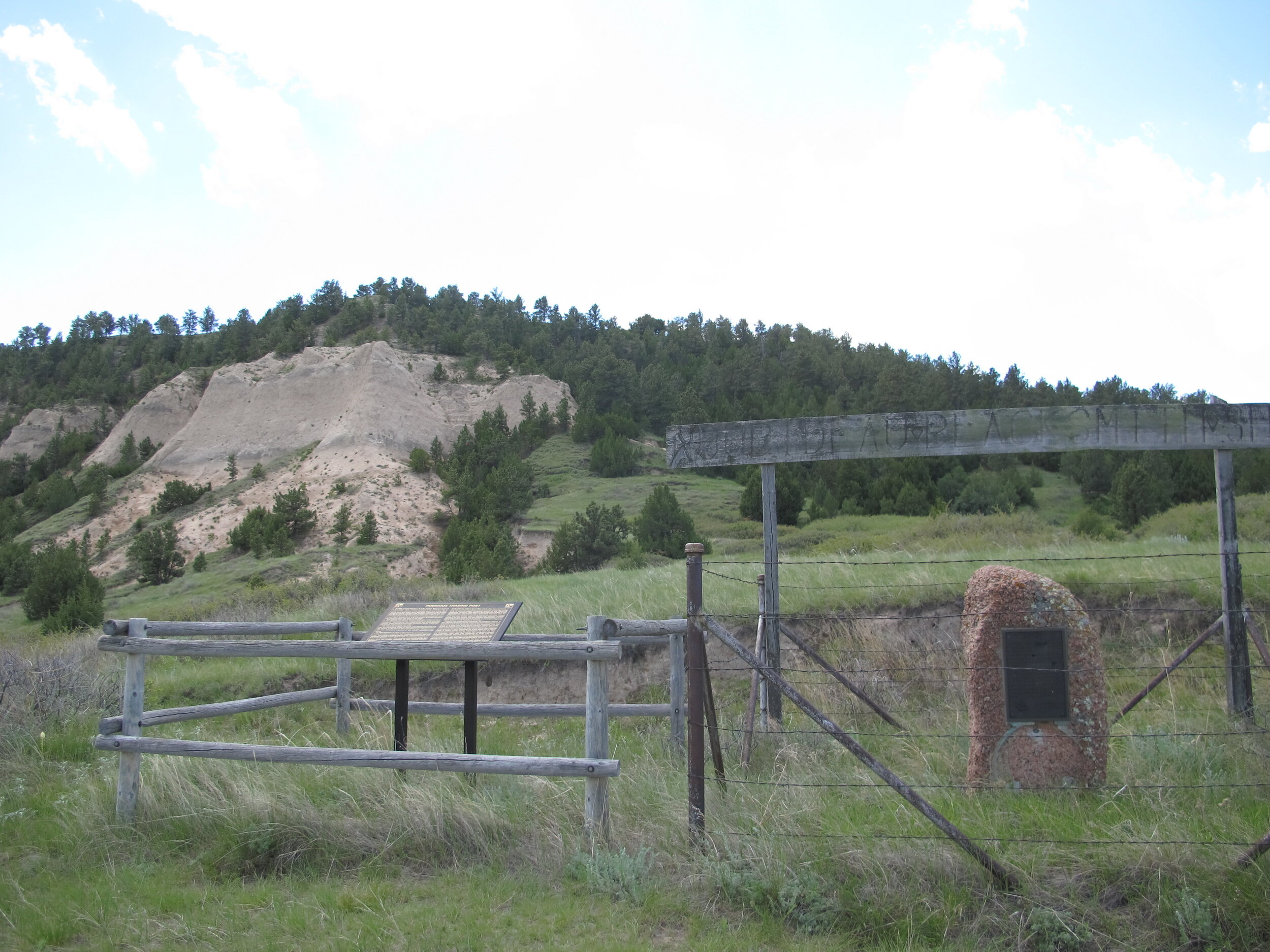
Robidoux's Blacksmith Post | Gering, NE
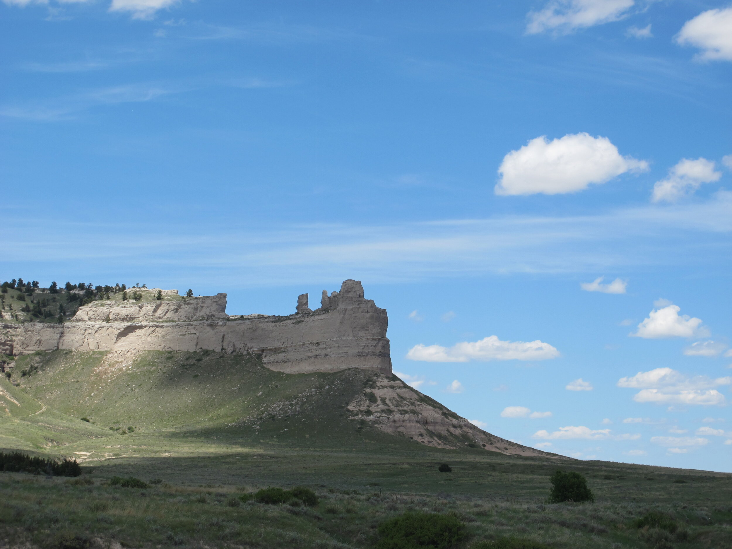
Scott's Bluff | Nebraska
Wyoming
Great stacks of cloud gathering over the mountains that seem to move towards you.
Trail ruts: Enter Guernsey then turn left on South Wyoming Ave. 0.9 miles then turn right onto dirt road (see brown directional sign). 0.5 miles then turn left to parking.
Trail still exhibiting deep wagon ruts 20 – Dwyer to Casper.
Register Cliff: R on South Wyoming Ave. 1.7 miles as it goes E and watch for sign, then left at sign. Swallows/chimney sweeps have made their home on Register Cliffs. Native American petroglyphs on Register Cliffs scrubbed out by white names and whiteness.
Heavily wooded La Prele Creek suddenly appears after miles of short-scrub landscape and stone overcroppings.
Giant metal jackalope N of Douglass of I-25.
Wyoming a state of energy: giant industrial powerlines and smoke stacks for steam and windmills and oil drills. Pronghorn antelope on plains. All near Glenrock. The danger is to view these monuments and parks as static relics of a built past.
Bluff faces are red south of Casper. Top of bluffs are really flat, ridged.

Fort Laramie | Wyoming

Register Cliff | Guernsey, Wyoming

Wyoming landscape before South Pass
Independence Rock looks like a whale (it’s in a riparian zone).
Devil’s Gate, Sweetwater River.
Rawlins, WY: back on road toward turn for 0.3 miles. Turn left and go uphill to monument.
After split, now the Wind River Range becomes visible.
Go through many giant humpback hills – grey, smooth like river stones. Then gentler undulating valley after Beaver Creek.
Oxblood rock and dirt after Twin Creek (10 miles SE of Lander). S of Lander valleys/hills populated by yellow wildflowers (May).
South Pass: From South Pass Rest Area go 0.7 miles S on WY 28. Sign says “Big Sandy Entrance to Bridger Wilderness.” Go another 0.2 miles. Turn left onto Oregon Buttes Rd. Go 2.8 miles (after second cattle guard), slowing where road turns right (look for ruts at turn). Right onto wagon tracks. South Pass overlook: 5.3 miles SW of rest area on E side of WY 28.
Past South Pass — much rockier, buttes in distance (West? South?).
Forb meadows at base of Wind River Mountains (insect population highest in May and June).
Sublette’s Cut-off (Parting of the Ways): mile marker 109.38 off US 189. (Fontenelle Reservoir here, 3.5 miles S of Cut-off).
Green River Ferry — timbered land to grassland, sheer to the banks. Broad river running SE. (Lombard Ferry). CITV didn’t go this far south.

Independence Rock | Alcova, Wyoming

Devil's Gate (Sweetwater River) | Wyoming

Wyoming landscape after South Pass
Utah
Lonely tracks in the salt desert. Mirage on salt makes it look like there’s a lake at the base of the mountains. When in fact it’s just a tease. The great magic trick of thirst and desperation.
Mountain are sheer faces of rock, the world stripped of vegetation. Tons of tiny, persistent gnats. Dead livestock would look like bleached sea creatures.

Great Salt Lake Desert, Utah
Nevada
Swampy/marshy Humboldt River. Ruby mountains around Elko. A wild, snoozing hoondle sighting (that’s our greyhound).
South fork near here. Grass Shoshone huts look like igloos (near Elko).
Emigrant Pass: Big hills and much greener. Hills endless in their repetition. Long-billed curlew in Winnemucca (a lush, wooded valley).

Nevada landscape
California
It’s calmer here than I thought — the river, the camp, Sutter’s Mill nothing extraordinary. But time has a tendency to damper. Also learned from a Park Ranger that, in 1849, all of these pines would simply be stumps, the trees cut down for lumber. It would be unbearable without this shade.

American River
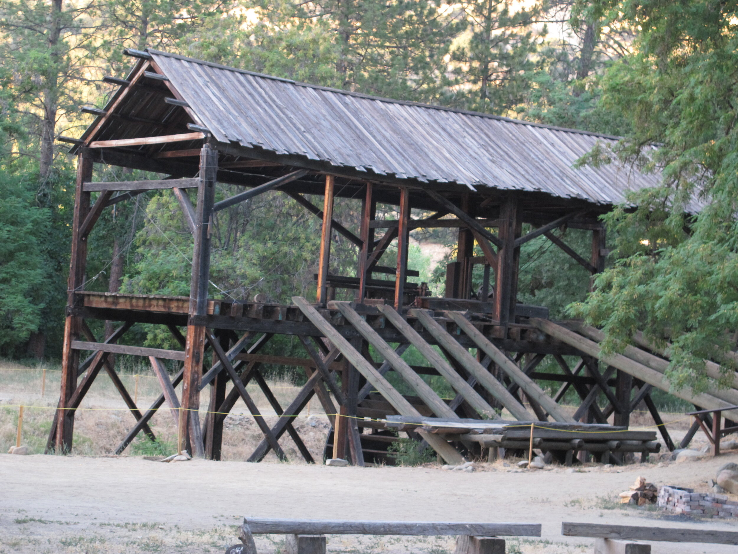
Sutter's Mill